
Geological and digital mapping and regional geology
Environmental protection and the sustainable use of natural resources require a detailed knowledge of geological and geomorphologic characteristics of the territory. Geosciences contribute to these pressing tasks with geological maps, a tool that is essential for the assessment of geological hazards, the territorial and infrastructure planning, environment safeguard and the georesources exploration, exploitation and management.
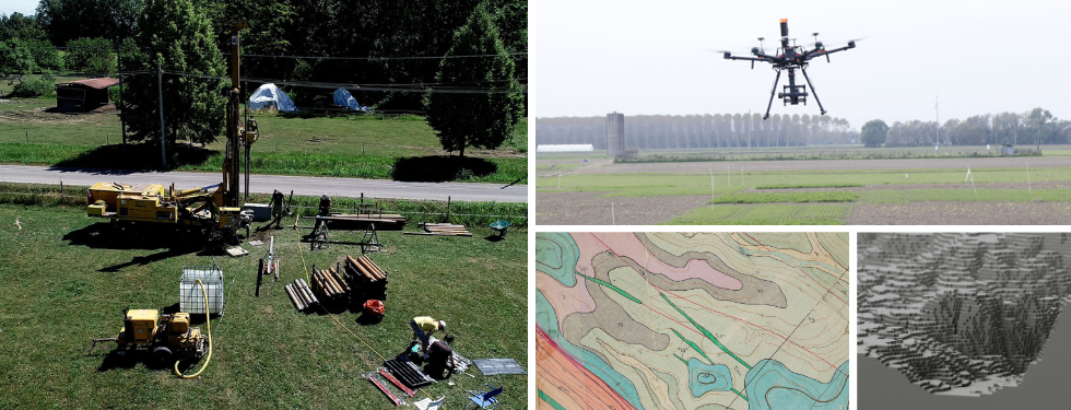
The Department of Geosciences is involved in national CARG Project (Geological CARtography) that is intended to create of 652 geological and geothematic sheets on a scale of 1:50,000 covering the entire national area (https://www.isprambiente.gov.it/Media/carg/) but also includes digital 3D models of the surface (Digital Outcrop Models) and of the subsurface geology.
The use of drones and photogrammetry techniques allow for digital outcrop models for engineering geology applications and earthquake mechanics studies. Furthermore, the Department is active in inventorying and managing geoheritage, at regional level as well as in the framework of international projects (see research line: Geoheritage and geosites in the topic Natural Resources, Raw Materials and Sustainability).
Professors coordinating and developing projects related to this research pathway: Anna Breda, Marcello Caggiati, Luca Capraro, Giulio Di Toro, Michele Fondriest, Alessandro Fontana, Eliana Fornaciari, Antonio Galgaro, Rodrigo Alfonso Gomila Olmos De Aguilera, Matteo Massironi, Paolo Mozzi, Giorgio Pennacchioni, Riccardo Pozzobon, Nereo Preto, Manuel Rigo, Cristina Stefani.