Eco-geomorphic CArbon Pumping from rivers To blUe caRbon Ecosystems

Title: Eco-geomorphic CArbon Pumping from rivers To blUe caRbon Ecosystems (e-CAPTURE)
Scientific Person in Charge: Andrea D'Alpaos | Programme: PRIN 2022 DM 104/2022
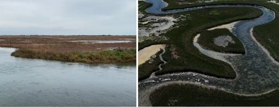
Although only 1% of the Earth's surface is covered by inland waters, their collective contribution to global carbon fluxes is substantially similar to terrestrial and marine ecosystems. Rivers and tidal systems are in fact formidable activators for atmospheric CO2 sequestration. However, as invoked during the EGU 2017 Bagnold Medal Lecture (E. Wohl), there is a tremendous need for modelling and quantification in River Carbon Science. The underlying idea of the project is that the riverine-estuarine system behaves as a combined virtuous cycle that catalyses the gross primary production, namely the carbon sequestered from the atmosphere. Within this virtuous cycle, the high fluvial morphological activity enhances the functioning of Blue Carbon Ecosystems (BCE). Under the overview of a multidisciplinary integrated approach (involving skills from morphodynamic modelling, remote sensing, field and laboratory analysis) we address the carbon cycle within the framework of a novel "Carbon Continuum", from inland to coastal wetlands. The project is composed of 3 Research Units (RU) and 1 Sub-unit, with an overall staff of 4 researchers, 4 postdocs specifically recruited for the project and 3 PhD students from other projects, and it is organised with a multiscale approach aiming to analyse the overall carbon budget of two selected watersheds: Amazon and Tagliamento (NE Italy). The project foresees joint collaborations among the RUs, with staff exchanges, transfer of knowledge and use of in-house resources of the RUs. All the planned activities will collect data about "hidden" C-fluxes that are strictly connected to eco-morphodynamic processes. At the basin scale, the use of free-access datasets available on the Google Earth Engine platform will enable the assessment of C-export from standing riparian vegetation. LiDAR, multispectral analysis and forest classification techniques will allow assessing the carbon budget at the reach and local scale. In this way, biomass change and distribution will be computed in different years. Field surveys will provide the assessment of organic carbon stored in vegetated soils along the fluvial-estuarine continuum and the measurements of CO2 evasion. A modelling framework will investigate the dynamics of Large Coarse Woods that are downed, mobilised, and stored in the river system during floods. An eco-morphodynamic model will be coupled with (i) a Lagrangian one for log tracking and (ii) a Wind Wave Tidal Model. A lumped mathematical model will be developed by integrating fluvial and tidal eco-geomorphology with C-sequestration. The resulting mathematical tool will be able to explore the effects of anthropogenic activity on the carbon balance and propose mitigation actions. The expected results will be fundamental for watershed management policies and could bring new, evidence-based findings into the discussion of carbon credits and in the development of new strategies for the reduction of anthropogenic emissions.