Seminar - Induced seismicity due to gas extraction: Experimental research on rock and fault behaviour in the Groningen gas field
Speaker: Dr. Andrè Niemeijer - Utrecht University, Netherlands | Tuesday 25 February 2025 | 4,30 PM - Arduino Classroom
25.02.2025
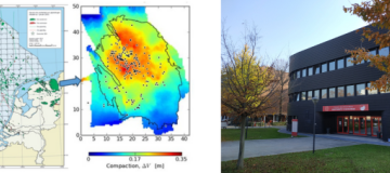
In 2012, a Mw 3.6 earthquake occurred in Huizinge, a small town in the North of the Netherlands. The earthquake was the result of the extraction of methane from one of the largest on-shore gas fields in the world, namely the Groningen gas field. Induced seismicity had been recorded since the 1990s,