Media and Events
A Roman Ostriarium in the Venetian Lagoon: the Discovery at Lio Piccolo Reveals an Ancient Landscape
17.04.2025
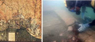
In the northern Venetian lagoon, at Lio Piccolo, archaeologists have uncovered a Roman ostriarium dating to the 1st century CE—the first ever found in Italy. The structure is a rectangular basin built with bricks and wooden planks, buried in the lagoon sediment, and used to keep oysters alive before